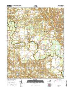
2016 Map of Manquin
USGS Topo · Published 2016About this map
The Pamunkey River serpentines across this landscape, forming the natural boundary between Hanover and King William counties. Near the center of the sheet, the Mechanicsville Tpke crosses the water at the Pamunkey River Bridge, connecting rural crossroads like Manquin and Central Garage. The area is defined by its deep colonial roots, evident in the names of long-standing religious centers such as Sharon Baptist Church and McKendree Methodist Church.
Find a feature on this map
94 named features on this map. Tap any name to fly to it.
Don’t see what you’re looking for? This feature index may not catch every label — zoom into the map to look around manually.
Map Details
Editions of this 2016 Manquin Map
This is the sole edition of this map. No revisions or reprints were ever made.
Other maps of this area

1894 · Richmond
USGS Topo · 1:62,500

1895 · Richmond
USGS Topo · 1:62,500

1918 · Doswell
USGS Topo · 1:62,500

1918 · Aylett
USGS Topo · 1:62,500

1920 · King William
USGS Topo · 1:62,500

1933 · Aylett
USGS Topo · 1:62,500

1934 · Seven Pines
USGS Topo · 1:24,000

1938 · Seven Pines
USGS Topo · 1:31,680

1938 · Studley
USGS Topo · 1:31,680

1943 · Richmond
USGS Topo · 1:250,000