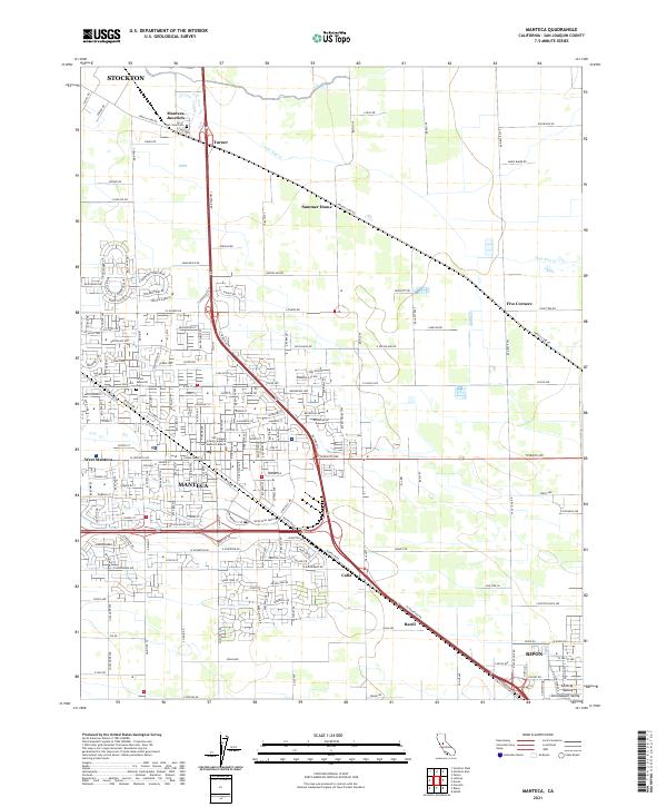
2021 Map of Manteca
USGS Topo · Published 2021About this map
The city of Manteca serves as the focal point for this survey of San Joaquin County, positioned as a major transportation corridor where modern highways and the Union Pacific Railroad converge. The landscape reveals the dense residential and civic development of West Manteca alongside essential local landmarks like the San Joaquin County Superior Court Manteca Branch. Beyond the urban core, the map details the irrigation-fed character of the San Joaquin Valley, with Lone Tree Cr cutting through the agricultural outskirts.
Find a feature on this map
82 named features on this map. Tap any name to fly to it.
Don’t see what you’re looking for? This feature index may not catch every label — zoom into the map to look around manually.
Map Details
Editions of this 2021 Manteca Map
This is the sole edition of this map. No revisions or reprints were ever made.
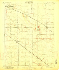
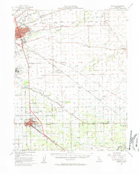
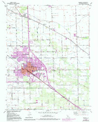
Historical Maps of Manteca Through Time
4 maps found