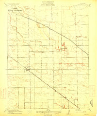
1914 Map of Manteca
USGS Topo · Published 1914About this map
Manteca stands as a primary hub for this San Joaquin County landscape during a period of significant agricultural and infrastructure development. The influence of the San Joaquin Irrigation District Ditch is evident, providing the necessary water for the region's transition into intensive farming. Transportation networks define the area's layout, with the Tidewater Southern and the Southern Pacific (Fresno Line) slicing across the grid, facilitating the movement of goods and people.
Find a feature on this map
17 named features on this map. Tap any name to fly to it.
Don’t see what you’re looking for? This feature index may not catch every label — zoom into the map to look around manually.
Map Details
Editions of this 1914 Manteca Map
2 editions found
Other maps of this area

1913 · Stockton
USGS Topo · 1:31,680

1914 · Burnham
USGS Topo · 1:31,680

1914 · Manteca
USGS Topo · 1:31,680

1914 · Avena
USGS Topo · 1:31,680

1915 · Vernalis
USGS Topo · 1:31,680

1915 · Lathrop
USGS Topo · 1:31,680

1915 · Ripon
USGS Topo · 1:31,680

1915 · Peters
USGS Topo · 1:31,680

1915 · Salida
USGS Topo · 1:31,680

1922 · Carbona
USGS Topo · 1:62,500