
1915 Map of Vernalis
USGS Topo · Published 1915About this map
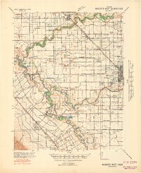
The San Joaquin River meanders sharply through the eastern half of this 1915 study, carving a complex network of bends and sloughs such as Reid Bridge Slough. This fluvial landscape contrasts with the rigid geometry of the railroads and land allotments to the west, where the Western Pacific and Southern Pacific corridors drive development. Small rural hubs like San Joaquin City and Vernalis anchor the river-and-rail economy, while the New Jerusalem School serves the surrounding ranching community. The map also delineates the extensive El Pescadero land grant, illustrating how older Spanish-era land patterns persisted alongside modern infrastructure. Subtle features like the Ohm siding and the Yarmouth station show the density of rail stops that supported Central Valley agriculture before the dominance of regional highways.
Find a feature on this map
13 named features on this map. Tap any name to fly to it.
Don’t see what you’re looking for? This feature index may not catch every label — zoom into the map to look around manually.
Map Details
Editions of this 1915 Vernalis Map
This is the sole edition of this map. No revisions or reprints were ever made.
Other maps of this area

1913 · Romain
USGS Topo · 1:31,680

1914 · Manteca
USGS Topo · 1:31,680

1914 · Union Island
USGS Topo · 1:31,680

1915 · Lathrop
USGS Topo · 1:31,680

1915 · Ripon
USGS Topo · 1:31,680

1915 · Westley
USGS Topo · 1:31,680

1916 · Tracy
USGS Topo · 1:31,680

1916 · Romain
USGS Topo · 1:31,680

1922 · Carbona
USGS Topo · 1:62,500
1941 · Modesto West
USGS Topo · 1:62,500