
1914 Map of Burnham
USGS Topo · Published 1914About this map
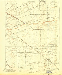
Agricultural development and early transportation networks dominate the landscape within the Campo De Los Franceses land grant as mapped in 1912. Small rural settlements like Collegeville and Burnham serve as hubs for a region defined by a dense grid of schools, including Mt Carmel School, Weber School, and Glenwood School, reflecting the community structure of the central San Joaquin Valley. The terrain is carefully managed through projects like the Stockton Diverting Canal, which redirects waters near Mormon Slough. A complex web of rail lines, including the Southern Pacific and the Atchison Topeka and Santa Fe, cuts diagonally across the township lines, illustrating the era's reliance on heavy rail for moving valley produce to market along routes like Mariposa Road.
Find a feature on this map
29 named features on this map. Tap any name to fly to it.
Don’t see what you’re looking for? This feature index may not catch every label — zoom into the map to look around manually.
Map Details
Editions of this 1914 Burnham Map
2 editions found
Other maps of this area

1894 · Lodi
USGS Topo · 1:125,000

1908 · Waterloo
USGS Topo · 1:31,680

1908 · Linden
USGS Topo · 1:31,680

1910 · Castle
USGS Topo · 1:31,680

1913 · Stockton
USGS Topo · 1:31,680

1914 · Manteca
USGS Topo · 1:31,680

1914 · Avena
USGS Topo · 1:31,680

1915 · Lathrop
USGS Topo · 1:31,680

1915 · Peters
USGS Topo · 1:31,680
1939 · Lodi
USGS Topo · 1:62,500