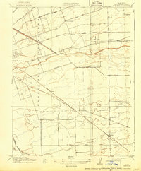
1914 Map of Burnham
USGS Topo · Published 1943About this map
Campo De Los Franceses dominates the western portion of this 1912 survey, reflecting the historical land grant legacy of San Joaquin County before the mid-century expansion of Stockton. The landscape is a geometric grid of rural roads and early twentieth-century infrastructure, characterized by an intensive network of schools and small settlements that served the local agricultural community. Local education is anchored by scattered sites like Chartville School, Mt Carmel School, and Weber School, indicating a well-distributed rural population.
Find a feature on this map
28 named features on this map. Tap any name to fly to it.
Don’t see what you’re looking for? This feature index may not catch every label — zoom into the map to look around manually.
Map Details
Editions of this 1914 Burnham Map
2 editions found
Other maps of this area

1894 · Lodi
USGS Topo · 1:125,000

1908 · Waterloo
USGS Topo · 1:31,680

1908 · Linden
USGS Topo · 1:31,680

1910 · Castle
USGS Topo · 1:31,680

1913 · Stockton
USGS Topo · 1:31,680

1914 · Burnham
USGS Topo · 1:31,680

1914 · Manteca
USGS Topo · 1:31,680

1914 · Avena
USGS Topo · 1:31,680

1915 · Lathrop
USGS Topo · 1:31,680

1915 · Peters
USGS Topo · 1:31,680