2022 Map of Manteo
USGS Topo · Published 2022About this map
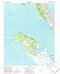
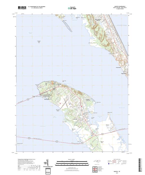
Fort Raleigh National Historic Site and the surrounding woodlands of the Alligator River National Wildlife Refuge anchor the northern tip of Roanoke Island. This coastal landscape is defined by the complex waterways of the Croatan Sound and Roanoke Sound, where early English colonial history meets modern preservation. The map details the transition from protected federal lands at the north to the established neighborhoods of Fort Raleigh City and the historic community at Mother Vineyard.
Find a feature on this map
103 named features on this map. Tap any name to fly to it.
Don’t see what you’re looking for? This feature index may not catch every label — zoom into the map to look around manually.
Map Details
Editions of this 2022 Manteo Map
This is the sole edition of this map. No revisions or reprints were ever made.
Historical Maps of California Through Time
5 maps found