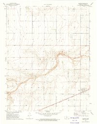
1973 Map of Manter
USGS Topo · Published 1975About this map
Manter stands as the primary hub in this western Kansas landscape, situated where the Atchison Topeka and Santa Fe railroad cuts across the plains. The 1973 survey reveals a rural infrastructure built around transport and resource extraction, with the Manter Cem and a nearby Radio Tower serving as local landmarks. The topography is defined by the winding paths of Bear Creek and Beaty Creek, which break the otherwise regular grid of section lines and wells. Smaller settlements or localities such as Swanson and Baskett provide important points of reference for genealogists tracing family land holdings in Stanton County. Evidence of local industry is visible through scattered excavations, including a Gravel Pit, a Caliche Pit, and a Drill Hole, reflecting the utility of the terrain during the early 1970s.
Find a feature on this map
14 named features on this map. Tap any name to fly to it.
Don’t see what you’re looking for? This feature index may not catch every label — zoom into the map to look around manually.
Map Details
Editions of this 1973 Manter Map
This is the sole edition of this map. No revisions or reprints were ever made.
Other maps of this area

1891 · Albany
USGS Topo · 1:125,000

1892 · Vilas
USGS Topo · 1:125,000

1893 · Albany
USGS Topo · 1:125,000

1900 · Syracuse
USGS Topo · 1:125,000

1920 · Syracuse
USGS Topo · 1:125,000

1955 · La Junta
USGS Topo · 1:250,000

1955 · Dodge City
USGS Topo · 1:250,000

1958 · La Junta
USGS Topo · 1:250,000

1958 · Dodge City
USGS Topo · 1:250,000

1959 · Dodge City
USGS Topo · 1:250,000