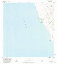
1981 Map of Manuka Bay
USGS Topo · Published 1981About this map
The southwest coast of the Island of Hawaii at the boundary of the South Kona District and Kau District is defined by recent volcanic activity and a stark, rocky shoreline. In the early 1980s, the landscape was dominated by extensive Lava Flow deposits and geological features such as Lava Tubes and a coastal Cave. Amidst the solidified flows are several kipukas—islands of older land surrounded by newer lava—including Kipuka Kaulanamauna, Kipuka Malua, and Kipuka Kaupuaa. These pockets represent preserved sections of the older landscape. Human presence is marked by cultural landmarks such as a Heiau near Manuka Bay and the Coast Guard Reservation at Kauna Pt. While formal settlements are sparse, the presence of Ruins and named locations like Hanakauumoe and Ahuloa suggest a history of habitation along this challenging terrain where the slopes of Manuka meet the Pacific Ocean.
Find a feature on this map
24 named features on this map. Tap any name to fly to it.
Don’t see what you’re looking for? This feature index may not catch every label — zoom into the map to look around manually.
Map Details
Editions of this 1981 Manuka Bay Map
This is the sole edition of this map. No revisions or reprints were ever made.
Other maps of this area

1928 · Hoopuloa
USGS Topo · 1:62,500

1954 · Hawaii South
USGS Topo · 1:250,000

1959 · Hawaii South
USGS Topo · 1:250,000

1961 · Hawaii South
USGS Topo · 1:250,000

1962 · Hawaii South
USGS Topo · 1:250,000

1962 · Milolii
USGS Topo · 1:24,000
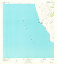
1962 · Manuka Bay
USGS Topo · 1:24,000

1962 · Pohue Bay
USGS Topo · 1:24,000

1962 · Papa
USGS Topo · 1:24,000

1975 · Hawaii
USGS Topo · 1:250,000