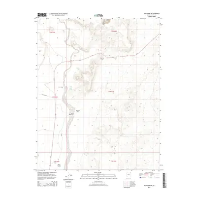
2014 Map of Many Farms NE
USGS Topo · Published 2014About this map
Many Farms sits at the southern edge of this Arizona landscape, positioned where the high desert terrain of the Chinle Valley meets a complex network of seasonal drainage systems. The map is defined by the significant path of the Chinle Wash, which is joined by tributaries including White Water Wash and Red Water Wash. These ephemeral watercourses cut through a region of dramatic topographic relief, including the elevated expanses of Carson Mesa to the west and the prominent Round Top Ridge near the center of the sheet.
Find a feature on this map
20 named features on this map. Tap any name to fly to it.
Don’t see what you’re looking for? This feature index may not catch every label — zoom into the map to look around manually.
Map Details
Editions of this 2014 Many Farms NE Map
This is the sole edition of this map. No revisions or reprints were ever made.
Other maps of this area

1892 · Canyon De Chelly
USGS Topo · 1:250,000

1953 · Los Gigantes SW
USGS Topo · 1:24,000

1953 · Los Gigantes Buttes
USGS Topo · 1:62,500

1954 · Shiprock
USGS Topo · 1:250,000

1955 · Sonsala Butte 2 SW
USGS Topo · 1:24,000

1955 · Sonsala Butte 2 NW
USGS Topo · 1:24,000
1955 · Yellowstone Canyon
USGS Topo · 1:62,500

1958 · Shiprock
USGS Topo · 1:250,000

1959 · Shiprock
USGS Topo · 1:250,000

1968 · Rock Point SW
USGS Topo · 1:24,000