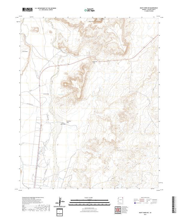
2021 Map of Many Farms NE
USGS Topo · Published 2021About this map
The high desert terrain of northeastern Arizona dominates this landscape, defined by the broad Chinle Valley and the massive Carson Mesa along the western edge. The drainage system of Chinle Wash acts as the primary hydrological artery, supplemented by the White Water Wash and Red Water Wash which cut through the arid valley floor. This 2021 topographic study illustrates the sparse transportation network that connects these remote points, including Old Denehotso Rd and several routes managed by Indian agencies.
Find a feature on this map
21 named features on this map. Tap any name to fly to it.
Don’t see what you’re looking for? This feature index may not catch every label — zoom into the map to look around manually.
Map Details
Editions of this 2021 Many Farms NE Map
This is the sole edition of this map. No revisions or reprints were ever made.
Other maps of this area

1892 · Canyon De Chelly
USGS Topo · 1:250,000

1953 · Los Gigantes SW
USGS Topo · 1:24,000

1953 · Los Gigantes Buttes
USGS Topo · 1:62,500

1954 · Shiprock
USGS Topo · 1:250,000

1955 · Sonsala Butte 2 SW
USGS Topo · 1:24,000

1955 · Sonsala Butte 2 NW
USGS Topo · 1:24,000
1955 · Yellowstone Canyon
USGS Topo · 1:62,500

1958 · Shiprock
USGS Topo · 1:250,000

1959 · Shiprock
USGS Topo · 1:250,000

1968 · Rock Point SW
USGS Topo · 1:24,000