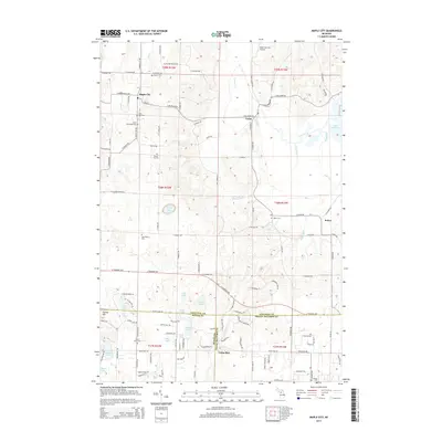
2014 Map of Maple City
USGS Topo · Published 2014About this map
Maple City and the surrounding township of Kasson serve as the focal point for this survey of the Leelanau Peninsula's interior. The landscape is defined by its rural heritage, with numerous family-named landmarks and local burial grounds such as Saint Rita Cem, Nash Pettengill Cem, and Round Top Cem scattered among the rolling hills. The settlement of Cedar sits to the east, while the village of Solon marks the eastern edge near the waters of Lake Leelanau.
Find a feature on this map
122 named features on this map. Tap any name to fly to it.
Don’t see what you’re looking for? This feature index may not catch every label — zoom into the map to look around manually.
Map Details
Editions of this 2014 Maple City Map
This is the sole edition of this map. No revisions or reprints were ever made.
Other maps of this area

1954 · Traverse City
USGS Topo · 1:250,000

1956 · Kingsley
USGS Topo · 1:62,500

1956 · Thompsonville
USGS Topo · 1:62,500

1957 · Traverse City
USGS Topo · 1:62,500

1957 · Maple City
USGS Topo · 1:62,500

1958 · Traverse City
USGS Topo · 1:250,000

1976 · Thompsonville NE
USGS Topo · 1:24,000

1976 · Thompsonville NW
USGS Topo · 1:24,000
1983 · Burdickville
USGS Topo · 1:24,000

1983 · Maple City
USGS Topo · 1:24,000