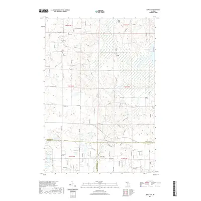
2019 Map of Maple City
USGS Topo · Published 2019About this map
Maple City and the neighboring village of Cedar serve as central points in this modern survey of Leelanau County's rural interior. The landscape is defined by its glacial heritage, characterized by numerous water bodies like Bright Lake, Hart Lake, and the sprawling Cedar Swamp. A high density of local burial grounds, including Kasson Cem, Saint Rita Cem, and the Nash-Pettengill Cem, reflects the long-standing community foundations in this area.
Find a feature on this map
128 named features on this map. Tap any name to fly to it.
Don’t see what you’re looking for? This feature index may not catch every label — zoom into the map to look around manually.
Map Details
Editions of this 2019 Maple City Map
This is the sole edition of this map. No revisions or reprints were ever made.
Other maps of this area

1954 · Traverse City
USGS Topo · 1:250,000

1956 · Kingsley
USGS Topo · 1:62,500

1956 · Thompsonville
USGS Topo · 1:62,500

1957 · Traverse City
USGS Topo · 1:62,500

1957 · Maple City
USGS Topo · 1:62,500

1958 · Traverse City
USGS Topo · 1:250,000

1976 · Thompsonville NE
USGS Topo · 1:24,000

1976 · Thompsonville NW
USGS Topo · 1:24,000
1983 · Burdickville
USGS Topo · 1:24,000

1983 · Maple City
USGS Topo · 1:24,000