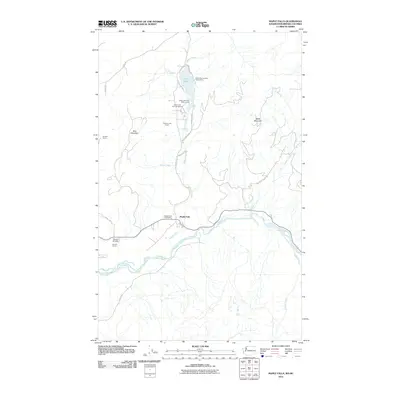
2011 Map of Maple Falls
USGS Topo · Published 2011About this map
Maple Falls sits along the bend of the North Fork Nooksack River in a valley defined by the high peaks of Red Mountain and Black Mountain. This 2011 survey records a landscape of recreational utility and extractive industry in northern Washington, centered around the Maple Falls Post Office and the mountain transit corridors of Silver Lake Rd. To the north, Silver Lake serves as a focal point for local leisure at the Silver Lake Park Campground and Silver Lake Park Boat Launch, while the nearby Black Mountain Boy Scout Camp occupies the eastern shore. The region’s economic foundation is represented by significant industrial sites, including the Clauson Lime Quarry and Kendall Quarry. Smaller landmarks like the Kendall Airstrip and numerous drainage creeks such as Doaks Creek and Boulder Creek illustrate the intersection of human infrastructure with the complex drainage systems of the Nooksack basin.
Find a feature on this map
26 named features on this map. Tap any name to fly to it.
Don’t see what you’re looking for? This feature index may not catch every label — zoom into the map to look around manually.
Map Details
Editions of this 2011 Maple Falls Map
This is the sole edition of this map. No revisions or reprints were ever made.
Other maps of this area

1909 · Mt Baker
USGS Topo · 1:192,000

1915 · Mt. Baker
USGS Topo · 1:250,000

1919 · Van Zandt
USGS Topo · 1:62,500

1951 · Van Zandt
USGS Topo · 1:62,500

1952 · Mt. Baker
USGS Topo · 1:62,500

1955 · Concrete
USGS Topo · 1:250,000

1957 · Victoria
USGS Topo · 1:250,000

1958 · Concrete
USGS Topo · 1:250,000

1962 · Concrete
USGS Topo · 1:250,000

1972 · Maple Falls
USGS Topo · 1:24,000