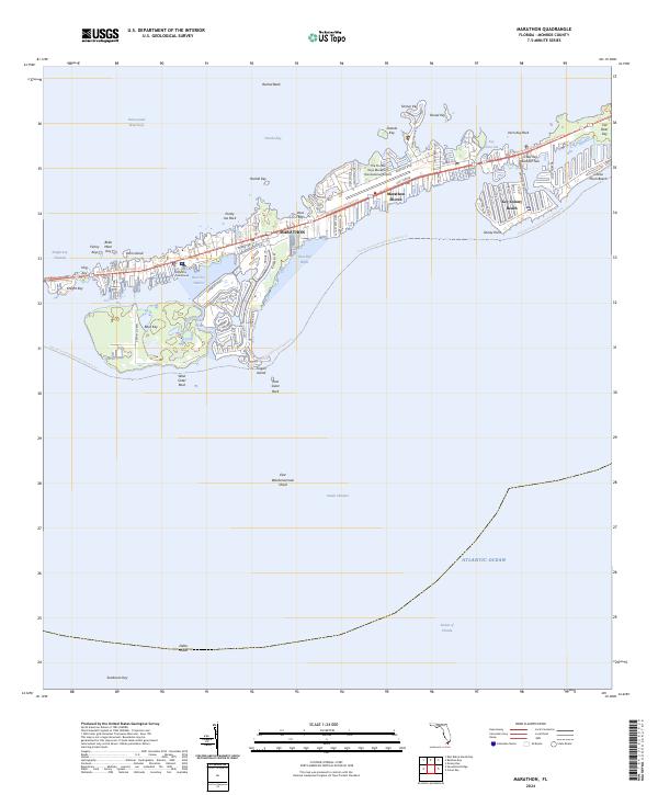
2024 Map of Marathon
USGS Topo · Published 2024About this map
Marathon and its neighboring island communities occupy a central position in the Middle Keys, defined by the narrow strip of Vaca Key where development is concentrated between Florida Bay and the Atlantic Ocean. The landscape is a complex network of residential canals and transportation corridors, notably the Florida Keys Overseas Heritage Trl and The Florida Keys Marathon International Airport. South of the main settlement, the protected waters of Boot Key Harbor separate the mainland from the mangrove-heavy terrain of Boot Key, which remains largely disconnected from the street grids of Marathon Shores and Key Colony Beach. Along the northern edge, the Intracoastal Waterway navigates past features like Rachel Bank and Vaca Cut, while the southern expanse reaches out toward Sombrero Key across the Hawk Channel. This modern survey illustrates the high density of coastal infrastructure, from the Marathon Courthouse to the various keys and rocks that form this specialized maritime environment.
Find a feature on this map
49 named features on this map. Tap any name to fly to it.
Don’t see what you’re looking for? This feature index may not catch every label — zoom into the map to look around manually.
Map Details
Editions of this 2024 Marathon Map
This is the sole edition of this map. No revisions or reprints were ever made.
Other maps of this area

1971 · Grassy Key
USGS Topo · 1:24,000

1971 · Marathon
USGS Topo · 1:24,000

1971 · Crawl Key
USGS Topo · 1:24,000

1972 · Marathon
USGS Topo · 1:24,000

1972 · Bamboo Key
USGS Topo · 1:24,000

1972 · East Bahia Honda Key
USGS Topo · 1:24,000

1972 · Sevenmile Bridge
USGS Topo · 1:24,000

1983 · Islamorada
USGS Topo · 1:100,000

1983 · Key West
USGS Topo · 1:100,000

1989 · Key West
USGS Topo · 1:250,000