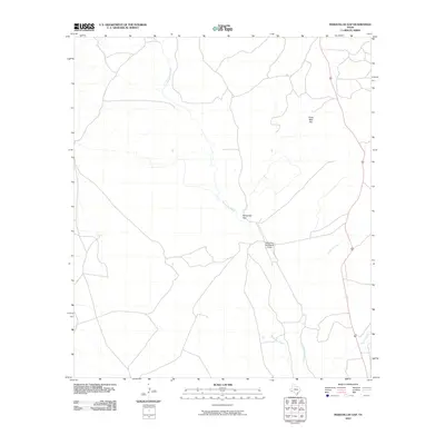
2010 Map of Maravillas Gap
USGS Topo · Published 2010About this map
Maravillas Gap forms a distinct natural passage through the high-desert terrain of Brewster County, serving as a focal point for local travel and infrastructure. The topographic landscape is defined by the winding course of Maravillas Creek, which is joined from the east by Hackberry Creek and Spring Creek. This drainage network reflects the arid climate's influence on the area's development, where water sources dictate the placement of ranching outposts and transportation routes. In the vicinity of the gap, the Maravillas Gap Ranch Airport provides an essential connection to this remote portion of West Texas. To the north, Three Mile Hill rises above the basin, anchoring a landscape where long-distance roads follow the natural contours of the desert floor. This 2010 survey provides a modern look at the land use and hydrology that has shaped life in the Big Bend region for generations.
Find a feature on this map
6 named features on this map. Tap any name to fly to it.
Don’t see what you’re looking for? This feature index may not catch every label — zoom into the map to look around manually.
Map Details
Editions of this 2010 Maravillas Gap Map
This is the sole edition of this map. No revisions or reprints were ever made.
Other maps of this area

1917 · Santiago Peak
USGS Topo · 1:62,500

1917 · Hood Spring
USGS Topo · 1:62,500

1918 · Bone Spring
USGS Topo · 1:125,000

1918 · Hood Spring
USGS Topo · 1:62,500

1918 · Santiago Peak
USGS Topo · 1:62,500

1920 · Monument Spring
USGS Topo · 1:62,500

1920 · Marathon
USGS Topo · 1:62,500

1921 · Monument Spring
USGS Topo · 1:62,500

1921 · Marathon
USGS Topo · 1:62,500

1931 · Hood Spring
USGS Topo · 1:62,500