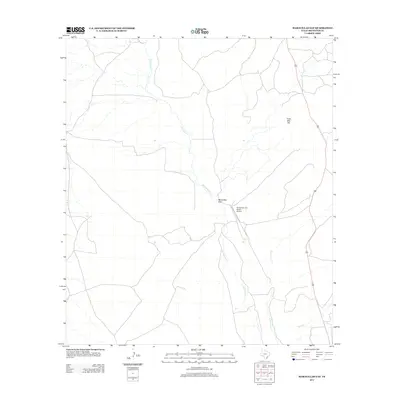
2012 Map of Maravillas Gap
USGS Topo · Published 2012About this map
Maravillas Gap serves as a prominent natural passage through the high terrain of Brewster County, where the desert landscape is defined by drainage patterns and isolated peaks. The ephemeral waters of Maravillas Cr wind through the center of the sheet, joined by Hackberry Cr and Spring Cr as they navigate the arid floor. Human activity in this portion of the Trans-Pecos is sparse, centered primarily on ranching infrastructure and the private Maravillas Gap Ranch Airport, which provides essential aerial access to this expansive country. To the northeast, the elevation of Three Mile Hill stands as a distinct navigational landmark for those traveling the limited road network that skirts the eastern edge of the quadrangle.
Find a feature on this map
6 named features on this map. Tap any name to fly to it.
Don’t see what you’re looking for? This feature index may not catch every label — zoom into the map to look around manually.
Map Details
Editions of this 2012 Maravillas Gap Map
This is the sole edition of this map. No revisions or reprints were ever made.
Other maps of this area

1917 · Santiago Peak
USGS Topo · 1:62,500

1917 · Hood Spring
USGS Topo · 1:62,500

1918 · Bone Spring
USGS Topo · 1:125,000

1918 · Hood Spring
USGS Topo · 1:62,500

1918 · Santiago Peak
USGS Topo · 1:62,500

1920 · Monument Spring
USGS Topo · 1:62,500

1920 · Marathon
USGS Topo · 1:62,500

1921 · Monument Spring
USGS Topo · 1:62,500

1921 · Marathon
USGS Topo · 1:62,500

1931 · Hood Spring
USGS Topo · 1:62,500