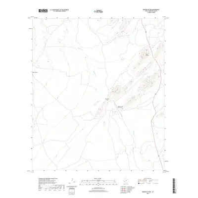
2019 Map of Maravillas Gap
USGS Topo · Published 2019About this map
Maravillas Gap defines the central topography of this Brewster County landscape, where the seasonal drainage of Maravillas Cr cuts through the high desert terrain. The area is characterized by significant elevation changes, ranging from the prominent Three Mile Hill in the northeast to the depths of Bear Canyon on the western edge. Transportation through this isolated region relies on the north-south corridor of US Route 385, which parallels the winding paths of Hackberry Cr and Spring Cr.
Find a feature on this map
8 named features on this map. Tap any name to fly to it.
Don’t see what you’re looking for? This feature index may not catch every label — zoom into the map to look around manually.
Map Details
Editions of this 2019 Maravillas Gap Map
This is the sole edition of this map. No revisions or reprints were ever made.
Other maps of this area

1917 · Santiago Peak
USGS Topo · 1:62,500

1917 · Hood Spring
USGS Topo · 1:62,500

1918 · Bone Spring
USGS Topo · 1:125,000

1918 · Hood Spring
USGS Topo · 1:62,500

1918 · Santiago Peak
USGS Topo · 1:62,500

1920 · Monument Spring
USGS Topo · 1:62,500

1920 · Marathon
USGS Topo · 1:62,500

1921 · Monument Spring
USGS Topo · 1:62,500

1921 · Marathon
USGS Topo · 1:62,500

1931 · Hood Spring
USGS Topo · 1:62,500