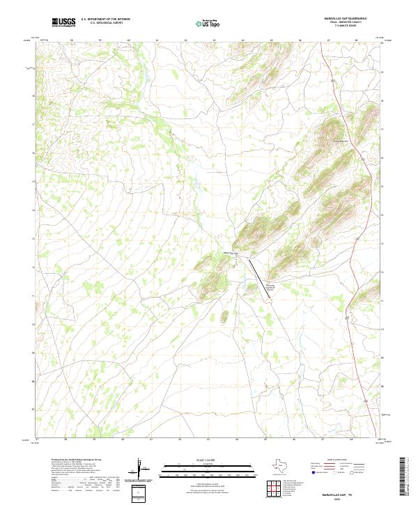
2022 Map of Maravillas Gap
USGS Topo · Published 2022About this map
Maravillas Gap defines this section of the West Texas landscape, where ephemeral watercourses like Maravillas Cr and Hackberry Cr carve through the high-desert terrain. The map documents a sparsely populated area characterized by remote ranching operations, centered around the Maravillas Gap Ranch Airport. The presence of this private airstrip underscores the isolation of the region, where air travel often supplements or replaces road transport over difficult ground. Rising to the northeast, Three Mile Hill serves as a prominent navigational landmark above the drainage basin of Spring Cr. This survey provides a precise look at the modern topography of southern Brewster County, tracing the intermittent drainage patterns and unpaved ranch roads that connect this corner of the Chihuahuan Desert to the rest of the state.
Find a feature on this map
7 named features on this map. Tap any name to fly to it.
Don’t see what you’re looking for? This feature index may not catch every label — zoom into the map to look around manually.
Map Details
Editions of this 2022 Maravillas Gap Map
This is the sole edition of this map. No revisions or reprints were ever made.
Other maps of this area

1917 · Santiago Peak
USGS Topo · 1:62,500

1917 · Hood Spring
USGS Topo · 1:62,500

1918 · Bone Spring
USGS Topo · 1:125,000

1918 · Hood Spring
USGS Topo · 1:62,500

1918 · Santiago Peak
USGS Topo · 1:62,500

1920 · Monument Spring
USGS Topo · 1:62,500

1920 · Marathon
USGS Topo · 1:62,500

1921 · Monument Spring
USGS Topo · 1:62,500

1921 · Marathon
USGS Topo · 1:62,500

1931 · Hood Spring
USGS Topo · 1:62,500