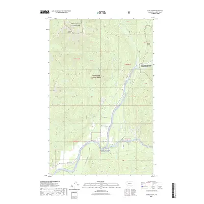
2020 Map of Marblemount
USGS Topo · Published 2020About this map
The Marblemount settlement sits at the strategic junction where the Skagit Wild and Scenic River meets the mountains, serving as a gateway to the high wilderness. This 2020 survey illustrates a landscape dominated by federal land management, with the boundaries of North Cascades National Park, Mount Baker National Forest, and the Ross Lake National Recreation Area converging near the river's path. Local infrastructure like Cascade River Rd and Rockport Cascade Rd provide access through the dense topography, while several family-named or descriptive landmarks such as Diobsud Buttes, Helen Buttes, and Bacon Point define the surrounding peaks. The map reveals a transition from the lower river valley bottomlands to the alpine environment of Olson Lake, tracing the various tributaries including Bacon Cr and Jordan Creek as they descend from the high timber.
Find a feature on this map
35 named features on this map. Tap any name to fly to it.
Don’t see what you’re looking for? This feature index may not catch every label — zoom into the map to look around manually.
Map Details
Editions of this 2020 Marblemount Map
This is the sole edition of this map. No revisions or reprints were ever made.
Other maps of this area

1899 · Glacier Peak
USGS Topo · 1:125,000

1899 · Stillaguamish
USGS Topo · 1:125,000

1901 · Glacier Peak
USGS Topo · 1:125,000

1901 · Stilaguamish
USGS Topo · 1:125,000

1909 · Mt Baker
USGS Topo · 1:192,000

1915 · Mt. Baker
USGS Topo · 1:250,000

1952 · Lake Shannon
USGS Topo · 1:62,500

1953 · Marblemount
USGS Topo · 1:62,500

1955 · Concrete
USGS Topo · 1:250,000

1958 · Concrete
USGS Topo · 1:250,000