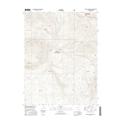
2016 Map of Marcellina Mountain
USGS Topo · Published 2016About this map
Marcellina Mountain and the Ruby Range anchor this high-elevation landscape within the Gunnison National Forest and White River National Forest. The 2016 survey highlights a complex drainage system where Ruby Anthracite Creek, Middle Anthracite Creek, and North Anthracite Creek converge, shaping features like the deep Dark Canyon and the prominent Devils Stairway. The geography is defined by basins and ridges, including Buck Basin, Silver Basin, and Snowline Ridge. Historical land use is evident in the network of pack and stock trails, such as the Munsey Ruby Stock Driveway Trail and the Oh-be-joyful Pass Trail, which provided critical access for high-country grazing and transit. Geologic landmarks like The Dyke and Mount Owen stand as distinctive navigational points in this roadless mountain environment.
Find a feature on this map
45 named features on this map. Tap any name to fly to it.
Don’t see what you’re looking for? This feature index may not catch every label — zoom into the map to look around manually.
Map Details
Editions of this 2016 Marcellina Mountain Map
This is the sole edition of this map. No revisions or reprints were ever made.
Other maps of this area

1888 · Anthracite
USGS Topo · 1:62,500

1889 · Anthracite
USGS Topo · 1:62,500

1893 · Anthracite
USGS Topo · 1:62,500

1894 · Anthracite
USGS Topo · 1:62,500

1938 · Mt. Gunnison
USGS Topo · 1:48,000

1945 · Mount Gunnison
USGS Topo · 1:62,500

1956 · Montrose
USGS Topo · 1:250,000

1957 · Leadville
USGS Topo · 1:250,000

1959 · Leadville
USGS Topo · 1:250,000

1959 · Montrose
USGS Topo · 1:250,000