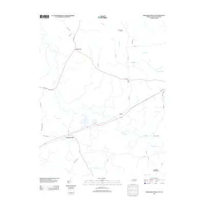
2013 Map of Margarettsville
USGS Topo · Published 2013About this map
The Meherrin River winds through this borderland between North Carolina and Virginia, defining a landscape of expansive wetlands and small rural settlements in the early twenty-first century. Margarettsville sits near the crossing of Cypress Cr, serving as a focal point for a network of local roads such as Big John Store Rd and Mount Carmel Rd. The mapping reveals a distinct pattern of small hamlets and crossroads, including Little Texas, White Head Hall, and Hugo, which are connected by a web of routes that navigate around the extensive drainage systems of Flat Swamp and Rogers Swamp.
Find a feature on this map
41 named features on this map. Tap any name to fly to it.
Don’t see what you’re looking for? This feature index may not catch every label — zoom into the map to look around manually.
Map Details
Editions of this 2013 Margarettsville Map
This is the sole edition of this map. No revisions or reprints were ever made.
Other maps of this area

1919 · Boykins
USGS Topo · 1:48,000

1919 · Arringdale
USGS Topo · 1:48,000

1920 · Boykins
USGS Topo · 1:62,500

1920 · Arringdale
USGS Topo · 1:62,500

1942 · Arringdale
USGS Topo · 1:62,500

1953 · Norfolk
USGS Topo · 1:250,000
1966 · Capron
USGS Topo · 1:24,000
1966 · Drewryville
USGS Topo · 1:24,000

1966 · Margarettsville
USGS Topo · 1:24,000
1966 · Adams Grove
USGS Topo · 1:24,000