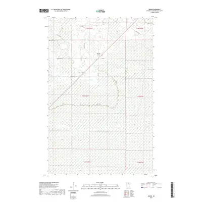
2019 Map of Margie
USGS Topo · Published 2019About this map
Margie serves as the central hub of this Koochiching County landscape, positioned along a transportation corridor defined by Ut 61 and Co RD 61. The area is characterized by an extensive network of forest roads and trails, including Wolf Trl, Pete Moe Forest Rd, and Big Meadow Rd, which cut through a terrain heavily defined by wetlands and small waterways. Notable water features like Dinner Cr and Hay Cr drain the surrounding lowlands, illustrating the hydrological challenges of settling this northern Minnesota territory. For those tracing local history or family roots, the presence of the Margie Cem southwest of the main settlement provides a vital genealogical landmark. The grid-like survey patterns of multiple townships, including t153n r26w and t154n r26w, show how the land was partitioned for forestry and development in a region where seasonal roads and forest trails remain the primary means of access.
Find a feature on this map
18 named features on this map. Tap any name to fly to it.
Don’t see what you’re looking for? This feature index may not catch every label — zoom into the map to look around manually.
Map Details
Editions of this 2019 Margie Map
This is the sole edition of this map. No revisions or reprints were ever made.
Other maps of this area

1918 · Zora
USGS Topo · 1:62,500

1919 · Zora
USGS Topo · 1:62,500

1919 · Lundgren
USGS Topo · 1:62,500

1919 · Gemmell
USGS Topo · 1:62,500

1919 · Margie
USGS Topo · 1:62,500

1954 · Bemidji
USGS Topo · 1:250,000

1954 · Hibbing
USGS Topo · 1:250,000

1954 · Roseau
USGS Topo · 1:250,000

1954 · International Falls
USGS Topo · 1:250,000

1957 · Roseau
USGS Topo · 1:250,000