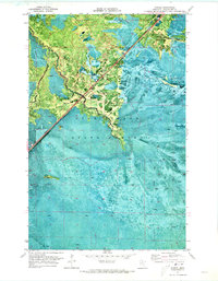
1970 Map of Margie
USGS Topo · Published 1973About this map
Margie stands as the primary settlement within this northern Minnesota landscape, situated along the Burlington Northern railroad corridor. The area is heavily defined by the wetlands and timber of the Pine Island State Forest, where the terrain is crossed by numerous seasonal routes including the Winter Trail. These winter-dependent roads were essential for navigating the boggy ground during the logging and transport seasons. Water drainage is facilitated by Dinner Creek, which snakes through the western portion of the quadrangle. For those researching local families, the Margie Cem is clearly indicated near the townsite, providing a specific point of reference for genealogy. The presence of a Gravel Pit near the northern rail line suggests the localized extraction of materials required for maintaining the remote transportation infrastructure in this bog-heavy environment.
Find a feature on this map
7 named features on this map. Tap any name to fly to it.
Don’t see what you’re looking for? This feature index may not catch every label — zoom into the map to look around manually.
Map Details
Editions of this 1970 Margie Map
This is the sole edition of this map. No revisions or reprints were ever made.
Other maps of this area

1918 · Zora
USGS Topo · 1:62,500

1919 · Zora
USGS Topo · 1:62,500

1919 · Lundgren
USGS Topo · 1:62,500

1919 · Gemmell
USGS Topo · 1:62,500

1919 · Margie
USGS Topo · 1:62,500

1954 · Bemidji
USGS Topo · 1:250,000

1954 · Hibbing
USGS Topo · 1:250,000

1954 · Roseau
USGS Topo · 1:250,000

1954 · International Falls
USGS Topo · 1:250,000

1957 · Roseau
USGS Topo · 1:250,000