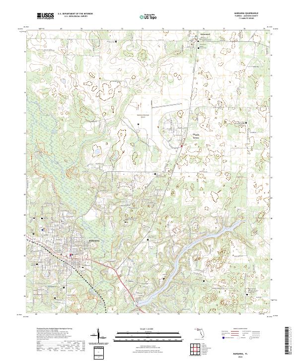
2024 Map of Marianna
USGS Topo · Published 2024About this map
The Jackson County Courthouse stands at the heart of this regional hub in northern Florida, where the city of Marianna serves as a gateway to unique geological and hydrologic features. The landscape is defined by the winding course of the Chipola River and the crystalline waters of Blue Spring and Baltzell Spring. To the northwest, the protected subterranean environments of Florida Caverns State Park highlight the area's karst topography, while the Merritt Mill Pond Paddling Trail to the east offers a recreational look at the region’s interconnected waterways.
Find a feature on this map
206 named features on this map. Tap any name to fly to it.
Don’t see what you’re looking for? This feature index may not catch every label — zoom into the map to look around manually.
Map Details
Editions of this 2024 Marianna Map
This is the sole edition of this map. No revisions or reprints were ever made.
Other maps of this area

1952 · Cypress
USGS Topo · 1:24,000

1952 · Oakdale
USGS Topo · 1:24,000

1952 · Kynesville
USGS Topo · 1:24,000

1952 · Dellwood
USGS Topo · 1:24,000

1952 · Cottondale East
USGS Topo · 1:24,000

1952 · Malone
USGS Topo · 1:24,000

1952 · Bascom
USGS Topo · 1:24,000

1952 · Sills
USGS Topo · 1:24,000

1952 · Marianna
USGS Topo · 1:24,000

1954 · Tallahassee
USGS Topo · 1:250,000