
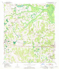
1952 Map of Cottondale East
USGS Topo · Published 1953About this map
Cottondale and the western outskirts of Marianna anchor this 1950s survey of Jackson County, defined by a landscape of limestone sinkholes and numerous small ponds. The Chipola River cuts through the northeast, while the Louisville and Nashville railroad and the Spanish Trail provide the primary east-west corridors. This era reveals a decentralized rural community supported by local institutions like Springfield Sch, Bethlehem Sch, and Jenkins Pond Sch.
Find a feature on this map
58 named features on this map. Tap any name to fly to it.
Don’t see what you’re looking for? This feature index may not catch every label — zoom into the map to look around manually.
Map Details
Editions of this 1952 Cottondale East Map
2 editions found
Other maps of this area

1952 · Oakdale
USGS Topo · 1:24,000

1952 · Kynesville
USGS Topo · 1:24,000

1952 · Malone
USGS Topo · 1:24,000

1952 · Campbellton
USGS Topo · 1:24,000

1952 · Cottondale West
USGS Topo · 1:24,000

1952 · Sills
USGS Topo · 1:24,000
1952 · Alford
USGS Topo · 1:24,000

1952 · Marianna
USGS Topo · 1:24,000

1954 · Tallahassee
USGS Topo · 1:250,000

1959 · Tallahassee
USGS Topo · 1:250,000