
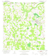
1952 Map of Campbellton
USGS Topo · Published 1953About this map
Campbellton serves as the focal point of this Jackson County survey, situated just south of the Alabama Florida state line where the Atlanta and St Andrews Bay railroad line intersects with the local road network. The landscape is dotted with numerous small water bodies such as Open Pond, Grant Pond, and Rum Pond, alongside a high concentration of community centers including the Shiloh Sch and Spring Hill Ch.
Find a feature on this map
34 named features on this map. Tap any name to fly to it.
Don’t see what you’re looking for? This feature index may not catch every label — zoom into the map to look around manually.
Map Details
Editions of this 1952 Campbellton Map
2 editions found
Other maps of this area

1942 · Enterprise
USGS Topo · 1:125,000

1950 · Chipley
USGS Topo · 1:24,000

1951 · Graceville
USGS Topo · 1:24,000

1951 · Chipley
USGS Topo · 1:24,000

1952 · Cottondale East
USGS Topo · 1:24,000

1952 · Cottondale West
USGS Topo · 1:24,000

1952 · Sills
USGS Topo · 1:24,000

1953 · Dothan
USGS Topo · 1:250,000

1954 · Dothan
USGS Topo · 1:250,000

1954 · Tallahassee
USGS Topo · 1:250,000