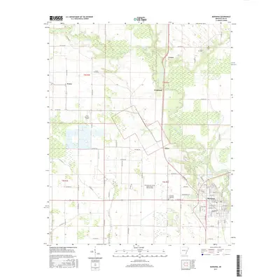
2017 Map of Marianna
USGS Topo · Published 2017About this map
Marianna serves as the focal point of this Lee County landscape, where the town street grid meets the winding course of the L'Anguille River. The surrounding delta terrain is defined by a dense network of rural routes such as Lee Road 402 and Lee Road 803, connecting smaller settlements like Canaan, Wrightland, and Felton. This survey illustrates a modern agricultural and aviation hub, featuring both the Marianna/Lee County Airport-Steve Edwards Field and Frost Flying Inc Airport. For genealogists, several burial sites are recorded across the townships, including Mound City Cem, Andrews Cem, and Haynie Cem, providing important spatial context for family history research in the region north of the town center.
Find a feature on this map
79 named features on this map. Tap any name to fly to it.
Don’t see what you’re looking for? This feature index may not catch every label — zoom into the map to look around manually.
Map Details
Editions of this 2017 Marianna Map
This is the sole edition of this map. No revisions or reprints were ever made.
Other maps of this area

1939 · Park Place
USGS Topo · 1:62,500

1939 · Latour
USGS Topo · 1:62,500

1940 · Marvell
USGS Topo · 1:62,500

1940 · Marianna
USGS Topo · 1:62,500

1948 · Helena
USGS Topo · 1:250,000

1950 · Helena
USGS Topo · 1:250,000

1955 · Park Place
USGS Topo · 1:62,500

1955 · Latour
USGS Topo · 1:62,500

1955 · Helena
USGS Topo · 1:250,000

1956 · Marvell
USGS Topo · 1:62,500