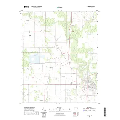
2020 Map of Marianna
USGS Topo · Published 2020About this map
Marianna serves as the focal point of this Arkansas Delta landscape, positioned where the L'Anguille River winds through the eastern portion of the sheet. The town's civic importance is anchored by the Lee County Courthouse, surrounded by a dense grid of residential and commercial streets. Beyond the town limits, the terrain transitions into a strictly organized agricultural pattern, typical of the region's productive bottomlands. Scattered rural communities such as Canaan, Wrightland, and Felton are connected by an extensive network of secondary routes like Hicky Rd and Caldwell Rd.
Find a feature on this map
80 named features on this map. Tap any name to fly to it.
Don’t see what you’re looking for? This feature index may not catch every label — zoom into the map to look around manually.
Map Details
Editions of this 2020 Marianna Map
This is the sole edition of this map. No revisions or reprints were ever made.
Other maps of this area

1939 · Park Place
USGS Topo · 1:62,500

1939 · Latour
USGS Topo · 1:62,500

1940 · Marvell
USGS Topo · 1:62,500

1940 · Marianna
USGS Topo · 1:62,500

1948 · Helena
USGS Topo · 1:250,000

1950 · Helena
USGS Topo · 1:250,000

1955 · Park Place
USGS Topo · 1:62,500

1955 · Latour
USGS Topo · 1:62,500

1955 · Helena
USGS Topo · 1:250,000

1956 · Marvell
USGS Topo · 1:62,500