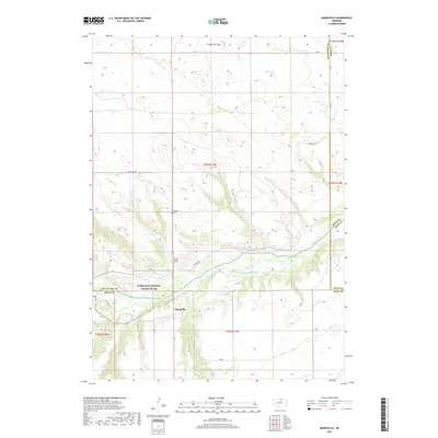
2017 Map of Mariaville
USGS Topo · Published 2017About this map
The Niobrara National Scenic River corridor dominates this northern Nebraska landscape, winding through a complex of bluffs and drainage systems. This 2017 survey details the area around Mariaville, a settlement positioned near the confluence of several creeks that feed the main river artery. The topography is defined by significant elevation changes, particularly around King Hill and the deep incisions made by waterways like Simpson Cr and Haughin Cr. Rural life is anchored by established sites such as the Simpson Cem and several water management features, including Cook Reservoir and Turpin Lake. The map captures the meeting point of Rock, Boyd, Keya Paha, and Holt counties, illustrating how section lines and local roads like Hay Valley Rd and Haugen Rd negotiate the uneven ground of the river valley.
Find a feature on this map
31 named features on this map. Tap any name to fly to it.
Don’t see what you’re looking for? This feature index may not catch every label — zoom into the map to look around manually.
Map Details
Editions of this 2017 Mariaville Map
This is the sole edition of this map. No revisions or reprints were ever made.
Other maps of this area

1949 · Jamison SW
USGS Topo · 1:24,000

1949 · Carns
USGS Topo · 1:24,000

1950 · Carns
USGS Topo · 1:24,000

1950 · Mariaville
USGS Topo · 1:24,000

1951 · Jamison SW
USGS Topo · 1:24,000

1951 · Naper SW
USGS Topo · 1:24,000

1954 · Stuart NW
USGS Topo · 1:24,000

1954 · Newport NE
USGS Topo · 1:24,000

1955 · O'Neill
USGS Topo · 1:250,000

1959 · O'Neill
USGS Topo · 1:250,000