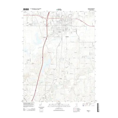
2015 Map of Marion
USGS Topo · Published 2015About this map
Marion is the central hub of this Williamson County landscape, where the urban grid gives way to the southern Illinois countryside and numerous waterways. The area is defined by the significant presence of regional water resources, including the Crab Orchard Creek drainage and the Marion Reservoir. Numerous historical burial grounds are documented across the terrain, from the Independent Order of Oddfellows Cem and Maplewood Cem in the north to the more secluded Koonce Cem near the S Fork Saline River. Small outlying settlements such as Bainbridge, Timmons, and Hudgens provide a clear view of how the population spread along transport corridors like Old Route 13 and the interstate system. To the south, the terrain becomes more varied around the Blackberry Hills and Hickory Hills, showing the transition toward the Saline River watershed.
Find a feature on this map
153 named features on this map. Tap any name to fly to it.
Don’t see what you’re looking for? This feature index may not catch every label — zoom into the map to look around manually.
Map Details
Editions of this 2015 Marion Map
This is the sole edition of this map. No revisions or reprints were ever made.
Other maps of this area

1909 · West Frankfort
USGS Topo · 1:62,500

1910 · Herrin
USGS Topo · 1:62,500

1922 · Carbondale
USGS Topo · 1:62,500

1925 · Marion
USGS Topo · 1:62,500

1936 · Herrin
USGS Topo · 1:62,500

1940 · Marion
USGS Topo · 1:62,500

1941 · Carbondale
USGS Topo · 1:62,500

1941 · West Frankfort
USGS Topo · 1:62,500

1949 · Paducah
USGS Topo · 1:250,000

1950 · Paducah
USGS Topo · 1:250,000