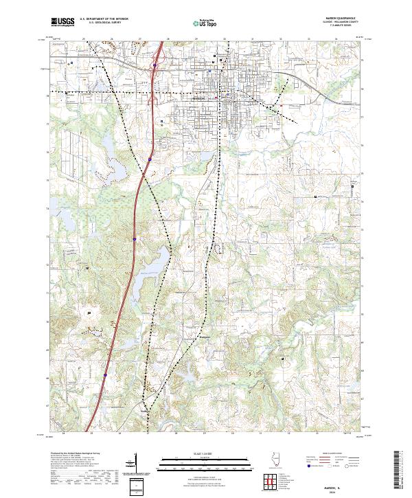
2024 Map of Marion
USGS Topo · Published 2024About this map
The city of Marion serves as the focal point for this survey, anchored by the Williamson County Courthouse at its center. This modern landscape reveals a dense network of city streets including W DeYoung St and E Main St that give way to the sprawling Crab Orchard National Wildlife Refuge to the west. A heavy concentration of burial grounds, such as Maplewood Cem, Rose Hill Cem, and the Independent Order of Oddfellows Cem, provides significant data for genealogical research within the city limits.
Find a feature on this map
31 named features on this map. Tap any name to fly to it.
Don’t see what you’re looking for? This feature index may not catch every label — zoom into the map to look around manually.
Map Details
Editions of this 2024 Marion Map
This is the sole edition of this map. No revisions or reprints were ever made.
Other maps of this area

1909 · West Frankfort
USGS Topo · 1:62,500

1910 · Herrin
USGS Topo · 1:62,500

1922 · Carbondale
USGS Topo · 1:62,500

1925 · Marion
USGS Topo · 1:62,500

1936 · Herrin
USGS Topo · 1:62,500

1940 · Marion
USGS Topo · 1:62,500

1941 · Carbondale
USGS Topo · 1:62,500

1941 · West Frankfort
USGS Topo · 1:62,500

1949 · Paducah
USGS Topo · 1:250,000

1950 · Paducah
USGS Topo · 1:250,000