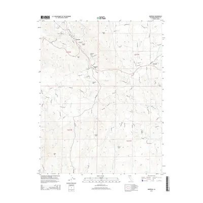
2015 Map of Mariposa
USGS Topo · Published 2015About this map
Mariposa and the surrounding foothill settlements of Mormon Bar and Bootjack appear in this 2015 study, illustrating the modern footprint of these storied Gold Rush-era locales. The terrain is defined by prominent elevations such as Stockton Ridge, Lookout Mtn, and Indian Mtn, which frame the drainages of Mariposa Cr and the W Fork Chowchilla River. Genealogists may find value in the location of Saint Joseph Cemetery near the town center, while local historians can trace naming patterns through features like John Allen Flat and McBrights Gulch. The map meticulously details the residential street network and rural connectors, from Jones St to the winding Darrah Rd, showing how contemporary development has integrated with the area's complex topography and historic landmarks like Striped Rock.
Find a feature on this map
99 named features on this map. Tap any name to fly to it.
Don’t see what you’re looking for? This feature index may not catch every label — zoom into the map to look around manually.
Map Details
Editions of this 2015 Mariposa Map
This is the sole edition of this map. No revisions or reprints were ever made.
Other maps of this area

1893 · Sonora
USGS Topo · 1:125,000

1896 · Sonora
USGS Topo · 1:125,000

1897 · Sonora
USGS Topo · 1:125,000

1897 · Yosemite
USGS Topo · 1:125,000

1898 · Sonora
USGS Topo · 1:125,000

1900 · Yosemite
USGS Topo · 1:125,000

1903 · Yosemite
USGS Topo · 1:125,000

1909 · Yosemite
USGS Topo · 1:125,000

1912 · Mariposa
USGS Topo · 1:125,000

1919 · Indian Gulch
USGS Topo · 1:48,000