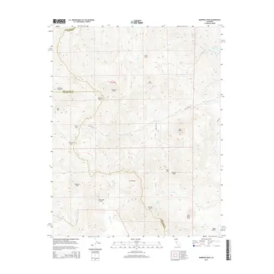
2015 Map of Mariposa Peak
USGS Topo · Published 2015About this map
Mariposa Peak and the high summits of the Diablo Range define this high-altitude borderland where Santa Clara, Merced, and San Benito counties meet. The landscape is characterized by a series of prominent peaks and deep drainage basins, including Antimony Peak and Henrietta Peak. To the south, the Quien Sabe Valley provides a rare pocket of flatter terrain amidst the steep ridges. Water systems here are vital markers of the geography, with the Arroyo De Las Viboras and Quien Sabe Cr cutting through the southern half of the sheet, while the northeastern corner shows the edge of the San Luis Reservoir. This survey highlights a remote ranching or wilderness area with very few developed roads, such as Billy Wright Rd, emphasizing the isolation of landmarks like Saint Marys Peak and the curiously named Log Trough Spring.
Find a feature on this map
34 named features on this map. Tap any name to fly to it.
Don’t see what you’re looking for? This feature index may not catch every label — zoom into the map to look around manually.
Map Details
Editions of this 2015 Mariposa Peak Map
This is the sole edition of this map. No revisions or reprints were ever made.
Other maps of this area

1919 · Hollister
USGS Topo · 1:48,000

1920 · Pacheco Pass
USGS Topo · 1:62,500

1921 · Gilroy Hot Springs
USGS Topo · 1:62,500

1921 · Hollister
USGS Topo · 1:62,500

1922 · Quien Sabe
USGS Topo · 1:62,500

1922 · San Luis Creek
USGS Topo · 1:31,680

1923 · Hollister
USGS Topo · 1:62,500

1939 · Gilroy Hot Springs
USGS Topo · 1:62,500

1940 · Gilroy Hot Springs
USGS Topo · 1:62,500

1940 · Hollister
USGS Topo · 1:62,500