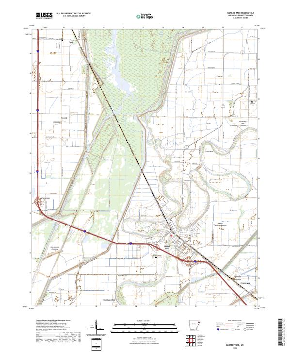
2024 Map of Marked Tree
USGS Topo · Published 2024About this map
Marked Tree serves as the central hub of this Poinsett County landscape, situated at the confluence of several significant water systems. The winding path of the Saint Francis River and the Left Hand Chute of Little River dominate the eastern and central regions, while the massive Oak Donnick Floodway and Saint Francis Lake define the hydrology of the western flats. This 2024 map illustrates a territory deeply shaped by water management and transit, with the Tyronza River cutting through the southeast corner near Tyronza Junction. Smaller settlements like Tulot, Cassidy, and Payneway are linked by a grid of agricultural roads, while the presence of Miller Mound and numerous family-named burial grounds like Nichols Cem and Tulot Cem provides clear indicators of the area's long-standing human occupation and heritage. This survey provides a contemporary view of the intersection between historic river routes and modern infrastructure, including the Marked Tree Municipal Airport.
Find a feature on this map
101 named features on this map. Tap any name to fly to it.
Don’t see what you’re looking for? This feature index may not catch every label — zoom into the map to look around manually.
Map Details
Editions of this 2024 Marked Tree Map
This is the sole edition of this map. No revisions or reprints were ever made.
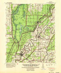
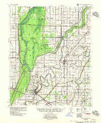
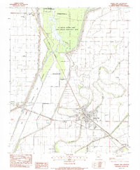
Historical Maps of Marked Tree Through Time
4 maps found