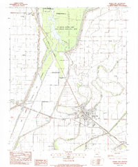
1983 Map of Marked Tree
USGS Topo · Published 1984About this map
The St Francis River and the Burlington Northern railroad intersect at Marked Tree, the primary hub of this Delta landscape in Poinsett County. This survey reflects a region defined by extensive drainage and flood control engineering, notably the Oak Donnick Floodway and the Bay St Francis. These systems manage the water levels of the St Francis Sunken Lands State Wildlife Management Area, a unique terrain of wetlands and bottomlands.
Find a feature on this map
36 named features on this map. Tap any name to fly to it.
Don’t see what you’re looking for? This feature index may not catch every label — zoom into the map to look around manually.
Map Details
Editions of this 1983 Marked Tree Map
This is the sole edition of this map. No revisions or reprints were ever made.
Other maps of this area

1940 · Deckerville
USGS Topo · 1:62,500

1940 · Princedale
USGS Topo · 1:62,500

1940 · Dee
USGS Topo · 1:62,500

1941 · Marked Tree
USGS Topo · 1:62,500

1953 · Memphis
USGS Topo · 1:250,000

1956 · Marked Tree
USGS Topo · 1:62,500

1956 · Memphis
USGS Topo · 1:250,000

1956 · Princedale
USGS Topo · 1:62,500

1957 · Deckerville
USGS Topo · 1:62,500

1958 · Dee
USGS Topo · 1:62,500