
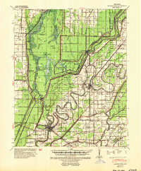
1941 Map of Marked Tree
USGS Topo · Published 1946About this map
Marked Tree serves as a central hub in this Mississippi River Commission study, where the St Francis River and the Tyronza River converge amidst a complex network of flood control infrastructure. The landscape is defined by the St Francis Sunken Lands, a reminder of the region's seismic and alluvial history, now interlaced with dozens of numbered drainage channels like Ditch No 18 and Ditch No 215. Significant engineering features such as the Rivervale Inverted Siphon and various siphons near Cypress Slough illustrate the intensive mid-century efforts to manage the wetlands for agriculture.
Find a feature on this map
86 named features on this map. Tap any name to fly to it.
Don’t see what you’re looking for? This feature index may not catch every label — zoom into the map to look around manually.
Map Details
Editions of this 1941 Marked Tree Map
2 editions found
Other maps of this area

1931 · Jericho
USGS Topo · 1:62,500

1939 · Jericho
USGS Topo · 1:62,500

1939 · Jonesboro
USGS Topo · 1:62,500

1939 · Evadale
USGS Topo · 1:62,500

1940 · Deckerville
USGS Topo · 1:62,500

1940 · Princedale
USGS Topo · 1:62,500

1940 · Dee
USGS Topo · 1:62,500

1941 · Leachville
USGS Topo · 1:62,500

1941 · Manila
USGS Topo · 1:62,500

1952 · Jericho
USGS Topo · 1:62,500