
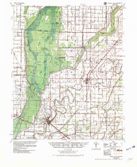
1956 Map of Marked Tree
USGS Topo · Published 1956About this map
Marked Tree sits at the heart of this mid-century survey, positioned where the St Louis San Francisco RR crosses the St Francis River. The landscape is defined by the massive St Francis Sunk Lands and Craighead Sunk Lands, complex wetland systems created by the New Madrid earthquakes. By the 1950s, this environment was heavily modified by an intricate network of drainage canals, including Ditch No 4 and Ditch No 85, which allowed for the expansion of agriculture and settlements like Lepanto and Tyronza Jct.
Find a feature on this map
148 named features on this map. Tap any name to fly to it.
Don’t see what you’re looking for? This feature index may not catch every label — zoom into the map to look around manually.
Map Details
Editions of this 1956 Marked Tree Map
2 editions found
Other maps of this area

1931 · Jericho
USGS Topo · 1:62,500

1939 · Jericho
USGS Topo · 1:62,500

1939 · Jonesboro
USGS Topo · 1:62,500

1939 · Evadale
USGS Topo · 1:62,500

1940 · Deckerville
USGS Topo · 1:62,500

1940 · Princedale
USGS Topo · 1:62,500

1940 · Dee
USGS Topo · 1:62,500

1941 · Leachville
USGS Topo · 1:62,500

1941 · Manila
USGS Topo · 1:62,500

1941 · Marked Tree
USGS Topo · 1:62,500