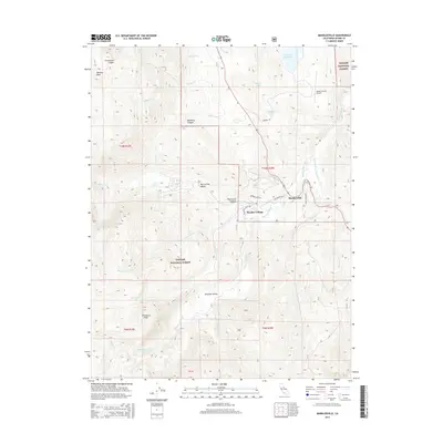
2015 Map of Markleeville
USGS Topo · Published 2015About this map
Markleeville serves as the focal point of this mountainous region in the eastern Sierra, situated near the confluence of Markleeville Creek and the East Fork Carson River. The landscape is dominated by high-elevation terrain within the Toiyabe National Forest, where peaks like Hawkins Peak and Thornburg Peak overlook a network of hydrologic features including Millberry Cr, Indian Cr, and Scott Cr.
Find a feature on this map
43 named features on this map. Tap any name to fly to it.
Don’t see what you’re looking for? This feature index may not catch every label — zoom into the map to look around manually.
Map Details
Editions of this 2015 Markleeville Map
This is the sole edition of this map. No revisions or reprints were ever made.
Other maps of this area

1889 · Markleeville
USGS Topo · 1:125,000

1891 · Markleeville
USGS Topo · 1:125,000

1893 · Markleeville
USGS Topo · 1:125,000

1948 · Walker Lake
USGS Topo · 1:250,000
1955 · Freel Peak
USGS Topo · 1:24,000

1956 · Freel Peak
USGS Topo · 1:62,500

1956 · Topaz Lake
USGS Topo · 1:62,500

1956 · Markleeville
USGS Topo · 1:62,500

1957 · Walker Lake
USGS Topo · 1:250,000
1957 · Mt. Siegel
USGS Topo · 1:62,500