Loading...
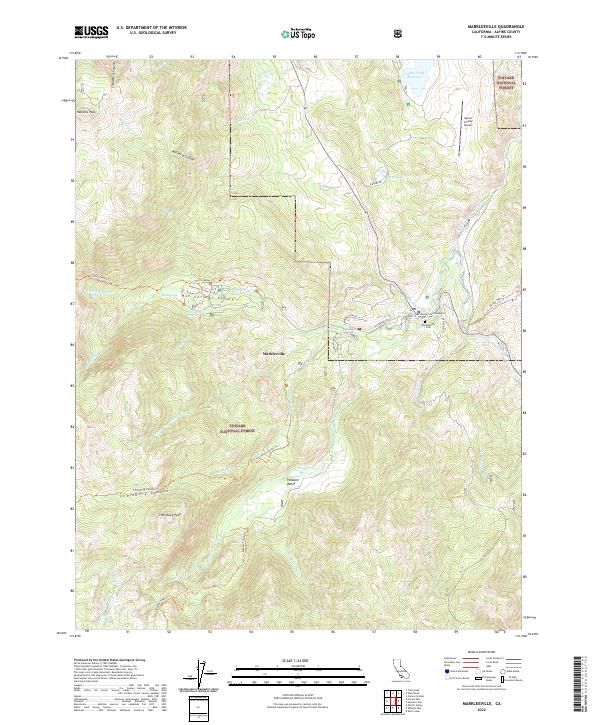
Loading map...2022 Map of Markleeville
USGS Topo · Published 2022About this map
Markleeville serves as the focal point of this high-elevation terrain, situated where Markleeville Creek meets the East Fork Carson River. The town layout includes the Alpine County Superior Court and the nearby Markleeville Cem, reflecting its status as a small but vital civic center. Steep canyons and prominent summits like Hawkins Peak and Thornburg Peak define the landscape, which is largely contained within the Toiyabe National Forest.
Find a feature on this map
49 named features on this map. Tap any name to fly to it.
Don’t see what you’re looking for? This feature index may not catch every label — zoom into the map to look around manually.
Map Details
Date Portrayed2022
Date Published2022
PublisherU.S. Geological Survey
Map TypeTopographic
Scale1:24000
Physical Dimensions24 x 29 inches
Editions of this 2022 Markleeville Map
This is the sole edition of this map. No revisions or reprints were ever made.
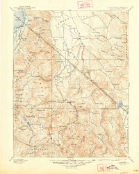
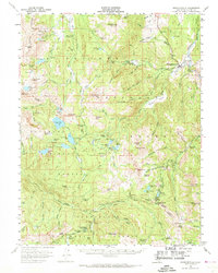
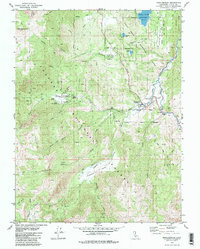
Historical Maps of Markleeville Through Time
6 maps found


Featured Locations
Source Details
SourceU.S. Geological Survey
CopyrightPublic Domain