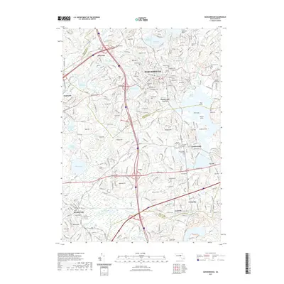
2021 Map of Marlborough
USGS Topo · Published 2021About this map
Marlborough serves as the focal point for this region where the industrial history of Middlesex and Worcester counties meets the protected waters of the Sudbury River system. The landscape is defined by its significant water infrastructure, from the Fort Meadow Reservoir in the north to the Millham Reservoir and Chauncy Lake in the west, reflecting the era's focus on resource management. Genealogists will find a wealth of specific data in the numerous burial sites, including the Old Burial Ground, Old Common Cem, and the Southborough Rural Cem. These sites, alongside landmarks like Marlborough Junction and the Assabet River Rail Trl, trace the transition from a traditional manufacturing hub to a suburban landscape. The topography is marked by distinct summits such as Sligo Hill and Mt-Vickery, which overlook a network of modern transit routes and historical paths like the Mwra: Wachusett Aqueduct Trl.
Find a feature on this map
102 named features on this map. Tap any name to fly to it.
Don’t see what you’re looking for? This feature index may not catch every label — zoom into the map to look around manually.
Map Details
Editions of this 2021 Marlborough Map
This is the sole edition of this map. No revisions or reprints were ever made.
Other maps of this area

1886 · Blackstone
USGS Topo · 1:62,500

1886 · Framingham
USGS Topo · 1:62,500

1887 · Franklin
USGS Topo · 1:62,500

1887 · Marlboro
USGS Topo · 1:62,500

1889 · Marlboro
USGS Topo · 1:62,500

1889 · Blackstone
USGS Topo · 1:62,500

1889 · Franklin
USGS Topo · 1:62,500

1889 · Framingham
USGS Topo · 1:62,500

1893 · Franklin
USGS Topo · 1:62,500

1893 · Blackstone
USGS Topo · 1:62,500