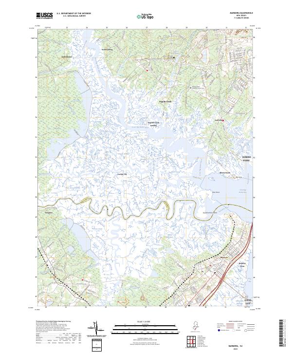
2023 Map of Marmora
USGS Topo · Published 2023About this map
Great Egg Harbor River and the Tuckahoe River define this coastal landscape where Atlantic Co and Cape May Co meet. The map documents an intricate network of tidal waterways and wetlands, including Griscom Swamp and Cedar Hammock Creek, which surround established settlements like Marmora and Tuckahoe. Historically significant landings such as Scull Landing, English Creek Landing, and Mosquito Landing highlight the region's long-standing connection to the river and bay. Local history is anchored by several prominent sites, including the Asbury Methodist Episcopal Church-Cem and Palestine Bible Protestant Church Cem. The geography transitions from the more developed edges of Somers Point and Ocean City to the complex estuarine environments of Great Egg Harbor Bay, showing the persistent balance between human habitation and the shifting coastal tides.
Find a feature on this map
161 named features on this map. Tap any name to fly to it.
Don’t see what you’re looking for? This feature index may not catch every label — zoom into the map to look around manually.
Map Details
Editions of this 2023 Marmora Map
This is the sole edition of this map. No revisions or reprints were ever made.
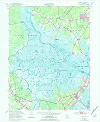
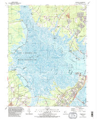
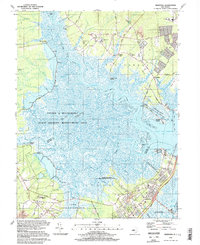
Historical Maps of Morris Beach Through Time
4 maps found