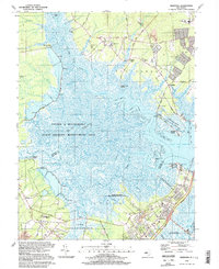
1994 Map of Marmora
USGS Topo · Published 1998About this map
The Tuckahoe River and Great Egg Harbor River converge at the heart of this coastal New Jersey landscape, creating a complex network of wetlands and tidal flats. Much of the terrain is dedicated to the Lester G Macnamara State Wildlife Management Area and the Cap May National Wildlife Refuge, indicating a region defined by conservation and natural marshland rather than dense urban sprawl. Settlement is concentrated in small communities like Marmora, Beesleys Point, and Scullville, often linked by historical routes such as Zion Road and the Garden State Parkway.
Find a feature on this map
76 named features on this map. Tap any name to fly to it.
Don’t see what you’re looking for? This feature index may not catch every label — zoom into the map to look around manually.
Map Details
Editions of this 1994 Marmora Map
2 editions found
Other maps of this area

1884 · Sea Isle
USGS Topo · 1:62,500

1888 · Dennisville
USGS Topo · 1:62,500

1888 · Sea Isle
USGS Topo · 1:62,500

1890 · Great Egg Harbor
USGS Topo · 1:62,500

1890 · Tuckahoe
USGS Topo · 1:62,500

1893 · Great Egg Harbor
USGS Topo · 1:62,500

1893 · Tuckahoe
USGS Topo · 1:62,500

1894 · Dennisville
USGS Topo · 1:62,500

1894 · Sea Isle
USGS Topo · 1:62,500

1918 · Great Egg Harbor
USGS Topo · 1:62,500