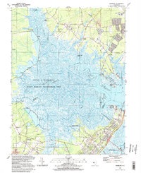
1994 Map of Marmora
USGS Topo · Published 1998About this map
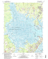
Great Egg Harbor and the Tuckahoe River dominate this coastal survey, where the boundary between Atlantic and Cape May counties follows the winding channels of the salt marsh. The landscape is a transition from established residential clusters like Beesleys Point and Marmora to the sprawling wetlands protected within the Lester G Macnamara State Wildlife Management Area. Development is concentrated along the Garden State Parkway corridor, yet the map preserves numerous small landings and family-named landmarks such as Scull Landing, Gibson Landing, and Jeffers Landing. Inland, the terrain rises slightly into woodland and fields, marked by local institutions including Palestine Church, Wesley Church, and the Seaside Cemetery. The presence of gravel pits and a powerplant near the bay indicates the local industrial activity supporting this coastal region in the late twentieth century.
Find a feature on this map
81 named features on this map. Tap any name to fly to it.
Don’t see what you’re looking for? This feature index may not catch every label — zoom into the map to look around manually.
Map Details
Editions of this 1994 Marmora Map
2 editions found
Other maps of this area

1884 · Sea Isle
USGS Topo · 1:62,500

1888 · Dennisville
USGS Topo · 1:62,500

1888 · Sea Isle
USGS Topo · 1:62,500

1890 · Great Egg Harbor
USGS Topo · 1:62,500

1890 · Tuckahoe
USGS Topo · 1:62,500

1893 · Great Egg Harbor
USGS Topo · 1:62,500

1893 · Tuckahoe
USGS Topo · 1:62,500

1894 · Dennisville
USGS Topo · 1:62,500

1894 · Sea Isle
USGS Topo · 1:62,500

1918 · Great Egg Harbor
USGS Topo · 1:62,500