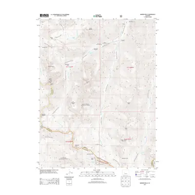
2013 Map of Maroon Bells
USGS Topo · Published 2013About this map
Maroon Bells and Maroon Peak dominate this high-elevation landscape along the boundary of White River National Forest and Gunnison National Forest. This 2013 survey details a complex network of high-altitude paths, including the Maroon Snowmass Trail 1975.1 and the West Maroon Pass Trail 1970.1, which trace the drainages of West Maroon Creek and East Maroon Creek. The map serves as a detailed guide to the remote interior of the Elk Mountains, locating specialized sites like the Conundrum Hot Springs and high-alpine bodies of water such as Willow Lake and Maroon Lake. Geological landmarks like the Pyramid Peak and Sleeping Sexton punctuate the ridges, while established sites like the Maroon Lake Campground and East Maroon Trailhead mark the primary points of entry for those navigating these steep mountain passes.
Find a feature on this map
56 named features on this map. Tap any name to fly to it.
Don’t see what you’re looking for? This feature index may not catch every label — zoom into the map to look around manually.
Map Details
Editions of this 2013 Maroon Bells Map
This is the sole edition of this map. No revisions or reprints were ever made.
Other maps of this area

1888 · Crested Butte
USGS Topo · 1:62,500

1888 · Anthracite
USGS Topo · 1:62,500

1889 · Crested Butte
USGS Topo · 1:62,500

1889 · Anthracite
USGS Topo · 1:62,500

1893 · Anthracite
USGS Topo · 1:62,500

1893 · Crested Butte
USGS Topo · 1:62,500

1893 · Aspen
USGS Topo · 1:62,500

1894 · Anthracite
USGS Topo · 1:62,500

1895 · Aspen
USGS Topo · 1:62,500

1909 · Mount Jackson
USGS Topo · 1:125,000