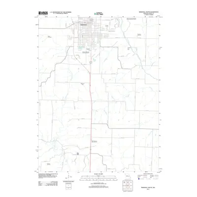
2012 Map of Marshall South
USGS Topo · Published 2012About this map
Marshall anchors the northern reaches of this Saline County landscape, where the town's grid gives way to a sprawling network of county roads and rural agricultural holdings. The southern portion of the map is defined by the hydrologic complexity of the Salt Fork and North Fork Finney Creek, alongside smaller tributaries like Dicks Branch and Crooked Creek. This era of land management is characterized by numerous water control structures, including the MFA Research Farm Lake Dam and the Little Sni-A-Bar Watershed Structure Number 27 Dam. For those researching local heritage, the map identifies several significant burial sites such as Fairview Cemetery, Ridge Park Cemetery, and Sunset Hill Cemetery. The transition from the urban infrastructure of the Marshall Memorial Municipal Airport to the natural features of Blue Lick Springs illustrates the varied character of the Missouri interior during the early 21st century.
Find a feature on this map
52 named features on this map. Tap any name to fly to it.
Don’t see what you’re looking for? This feature index may not catch every label — zoom into the map to look around manually.
Map Details
Editions of this 2012 Marshall South Map
This is the sole edition of this map. No revisions or reprints were ever made.
Other maps of this area

1887 · Sedalia
USGS Topo · 1:125,000

1890 · Marshall
USGS Topo · 1:125,000

1892 · Marshall
USGS Topo · 1:125,000

1894 · Sedalia
USGS Topo · 1:125,000

1901 · Marshall
USGS Topo · 1:125,000

1939 · Sweet Springs
USGS Topo · 1:62,500

1940 · Sweet Springs
USGS Topo · 1:62,500

1940 · Marshall
USGS Topo · 1:62,500

1941 · Sweet Springs
USGS Topo · 1:62,500

1944 · Marshall
USGS Topo · 1:62,500