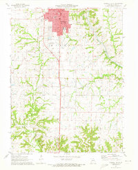
1971 Map of Marshall South
USGS Topo · Published 1973About this map
Marshall serves as the focal point of this Saline County survey, dominated by a dense grid of civic and educational institutions. The campus of Missouri Valley College and the Vocational and Technical Sch anchor the southern part of the city, while the Courthouse, City Hall, and Po define the municipal center. The local infrastructure of the early 1970s is well-documented, showing the Gulf Mobile and Ohio railroad corridor and the Marshall Memorial Airport alongside residential developments like Town and Country Lake.
Find a feature on this map
36 named features on this map. Tap any name to fly to it.
Don’t see what you’re looking for? This feature index may not catch every label — zoom into the map to look around manually.
Map Details
Editions of this 1971 Marshall South Map
This is the sole edition of this map. No revisions or reprints were ever made.
Other maps of this area

1887 · Sedalia
USGS Topo · 1:125,000

1890 · Marshall
USGS Topo · 1:125,000

1892 · Marshall
USGS Topo · 1:125,000

1894 · Sedalia
USGS Topo · 1:125,000

1901 · Marshall
USGS Topo · 1:125,000

1939 · Sweet Springs
USGS Topo · 1:62,500

1940 · Sweet Springs
USGS Topo · 1:62,500

1940 · Marshall
USGS Topo · 1:62,500

1941 · Sweet Springs
USGS Topo · 1:62,500

1944 · Marshall
USGS Topo · 1:62,500