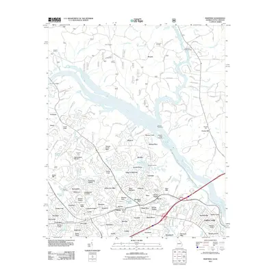
2011 Map of Martinez
USGS Topo · Published 2011About this map
The Savannah River divides the landscape on this 2011 survey, carving a path through a region transitioning from rural riverbanks to densely developed suburban neighborhoods. The Georgia side is characterized by an intricate network of residential communities such as Village at Watervale, Shenandoah Woods, and Bonaire Heights, centering around the Martinez Post Office. Local history is anchored by numerous family and community burial grounds, including Hopewell Cemetery, Taylor Cemetery, and Abilene Cemetery.
Find a feature on this map
96 named features on this map. Tap any name to fly to it.
Don’t see what you’re looking for? This feature index may not catch every label — zoom into the map to look around manually.
Map Details
Editions of this 2011 Martinez Map
This is the sole edition of this map. No revisions or reprints were ever made.
Other maps of this area

1892 · Mc Cormick
USGS Topo · 1:125,000

1912 · Mc Cormick
USGS Topo · 1:125,000

1920 · Clarks Hill
USGS Topo · 1:48,000

1921 · Augusta
USGS Topo · 1:62,500

1921 · Clarks Hill
USGS Topo · 1:62,500

1922 · Hephzibah
USGS Topo · 1:62,500

1923 · Warrenville
USGS Topo · 1:48,000

1928 · Warrenville
USGS Topo · 1:62,500

1941 · Clarks Hill
USGS Topo · 1:62,500

1942 · Clarks Hill
USGS Topo · 1:62,500