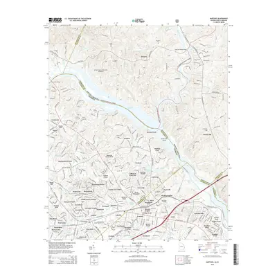
2014 Map of Martinez
USGS Topo · Published 2014About this map
The Savannah River carves a deep boundary between Georgia and South Carolina on this 2014 survey, highlighting the transition from the dense residential developments of Martinez to the protected woodlands of the Sumter National Forest. The landscape is defined by the river’s complex geography, including the Ninety Nine Islands and the Four Mile Reach bend. Suburban growth is evident in the sprawling neighborhood networks of Watervale, Westlake, and Montclair, which contrast sharply with the quiet, rural character of Morgana across the state line.
Find a feature on this map
93 named features on this map. Tap any name to fly to it.
Don’t see what you’re looking for? This feature index may not catch every label — zoom into the map to look around manually.
Map Details
Editions of this 2014 Martinez Map
This is the sole edition of this map. No revisions or reprints were ever made.
Other maps of this area

1892 · Mc Cormick
USGS Topo · 1:125,000

1912 · Mc Cormick
USGS Topo · 1:125,000

1920 · Clarks Hill
USGS Topo · 1:48,000

1921 · Augusta
USGS Topo · 1:62,500

1921 · Clarks Hill
USGS Topo · 1:62,500

1922 · Hephzibah
USGS Topo · 1:62,500

1923 · Warrenville
USGS Topo · 1:48,000

1928 · Warrenville
USGS Topo · 1:62,500

1941 · Clarks Hill
USGS Topo · 1:62,500

1942 · Clarks Hill
USGS Topo · 1:62,500