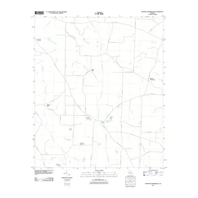
2011 Map of Martins Crossroads
USGS Topo · Published 2011About this map
Pachitla Creek and its many tributaries, including Goffs Mill Creek and Carter Creek, dominate this rural Randolph County landscape. The mapping of Goffs Mill and Shivers Mill points to a history of water-powered industry that once supported local agriculture. This 2011 survey reveals a landscape of dispersed farmsteads and small crossroads communities, most notably Martins Crossroads in the northeast. Genealogy researchers will find significant value in the detailed plotting of the Damascus Baptist Church Cemetery and New Bethel Baptist Church Cemetery. The presence of small private aviation infrastructure like Grubbs Airport alongside numerous managed water bodies such as Curry Lake and Williams Lake reflects the modern land use patterns of this agricultural region in Southwest Georgia.
Find a feature on this map
58 named features on this map. Tap any name to fly to it.
Don’t see what you’re looking for? This feature index may not catch every label — zoom into the map to look around manually.
Map Details
Editions of this 2011 Martins Crossroads Map
This is the sole edition of this map. No revisions or reprints were ever made.
Other maps of this area

1953 · Dothan
USGS Topo · 1:250,000

1954 · Dothan
USGS Topo · 1:250,000

1955 · Dothan
USGS Topo · 1:250,000

1972 · Shellman
USGS Topo · 1:24,000
1972 · Brooksville
USGS Topo · 1:24,000
1972 · Cuthbert
USGS Topo · 1:24,000

1973 · Morgan
USGS Topo · 1:24,000

1973 · Martins Crossroads
USGS Topo · 1:24,000
1973 · Doverel
USGS Topo · 1:24,000

1973 · Edison
USGS Topo · 1:24,000